




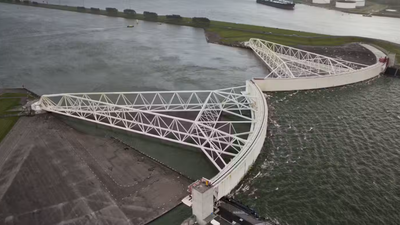
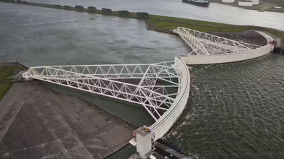
In the Netherlands, two enormous gates, each 210 metres wide, can close against the North Sea to hold back dangerous storm surges. Known as the Maeslant Barrier, the structure stands near Hoek van Holland and was built between 1991 and 1997. According to Rijkswaterstaat, the Dutch agency that manages it, no other flood barrier in the world has larger moving parts. The barrier closes fully automatically when water levels are forecast to rise dangerously, and it helps protect residents of the province of Zuid-Holland. This article explains how it works, what it measures, and who keeps it ready and tested.
How the Maeslant Barrier near Hoek van Holland protects Zuid-Holland from North Sea storm surges
Ministry of Infrastructure and Water Management, Rijkswaterstaat, describes Maeslant Barrier as a vital part of the Delta Works, the Dutch system of flood defences. It is designed to withstand a storm surge of 5 metres above a reference level that roughly equals the average sea level in the North Sea. The barrier sits in the New Waterway and is a forward flood surge barrier, which means it takes the full force of the tidal surge coming in from the sea. Together with the Hartel Barrier and the extended Rozenburg Dyke, it forms the Europoort Barrier.
How the barrier was designed and built between 1991 and 1997
Rijkswaterstaat explains that the Maeslant Barrier was not part of the original Delta Plan, yet its design is just as ingenious and massive as the other Delta Works structures. Before construction, an independent committee examined four options for the barrier, working closely with Rijkswaterstaat, the municipality of Rotterdam, and the water authority. The committee weighed cost, building time, the effect on the economy, and how well the barrier would blend into the landscape. Construction ran from 1991 to 1997, and the barrier was closed for the first time in 2007.
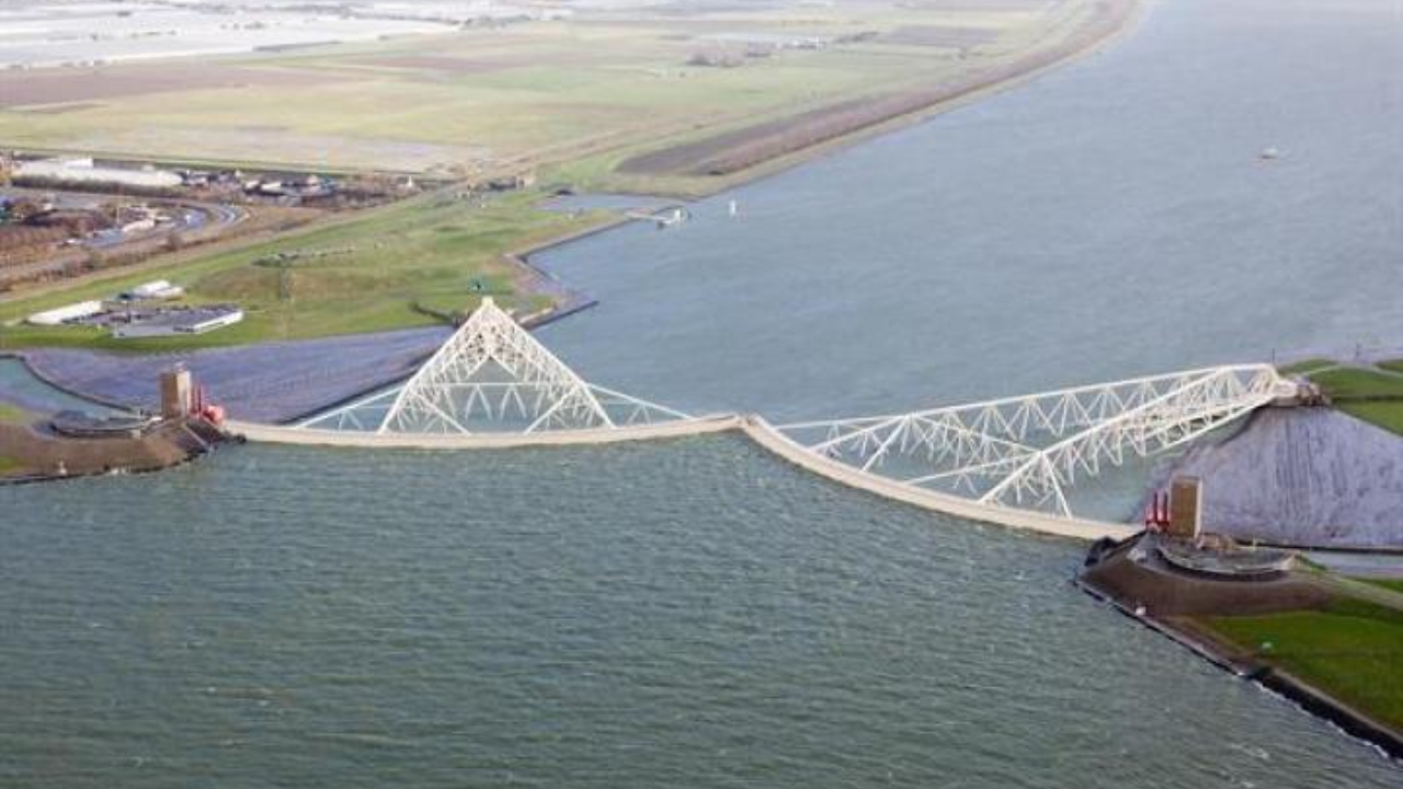
Built between 1991 and 1997, it is 420 metres long (Image: The Watersnood Museum)
How two gates, each 210 metres wide, fill with water and sink within two hours
According to the Keringhuis water information centre in Hoek van Holland, the barrier has two gates, each 210 metres wide, 22 metres high, and 15 metres deep. Rijkswaterstaat explains that when the barrier closes, the gates fill with water and sink to the bottom, and the Keringhuis says the whole closing takes two hours. The structure turns on ball-and-socket joints, each 10 metres in diameter and weighing 680 tons. Both organisations state that no other flood barrier in the world has larger moving parts. Rijkswaterstaat also uses a specially developed model to calculate the risk that the barrier fails to close.
How the Maeslant Barrier closes fully automatically, when it has closed, and when operators step in
Rijkswaterstaat says the barrier closes automatically when the water level near Rotterdam is predicted to rise more than 3 metres above the reference level, or more than 2.9 metres near Dordrecht, and that “No human intervention is required.” An operational team is still on hand to monitor and step in if needed. The Keringhuis reports that the barrier closed on 21 December 2023 for the first time at its official threshold, when the Rotterdam forecast reached 3 metres. It had twice closed earlier at a lowered threshold of 2.6 metres, in November 2007 and January 2018. In storms in 2002, 2013, and 2014 it came within a few centimetres of closing. Visitors can learn more at the Keringhuis.